
Affordable
LandForm® X is very affordable compared to legacy ISR Mission Management Systems. If you are interested in receiving a quote, please contact us.
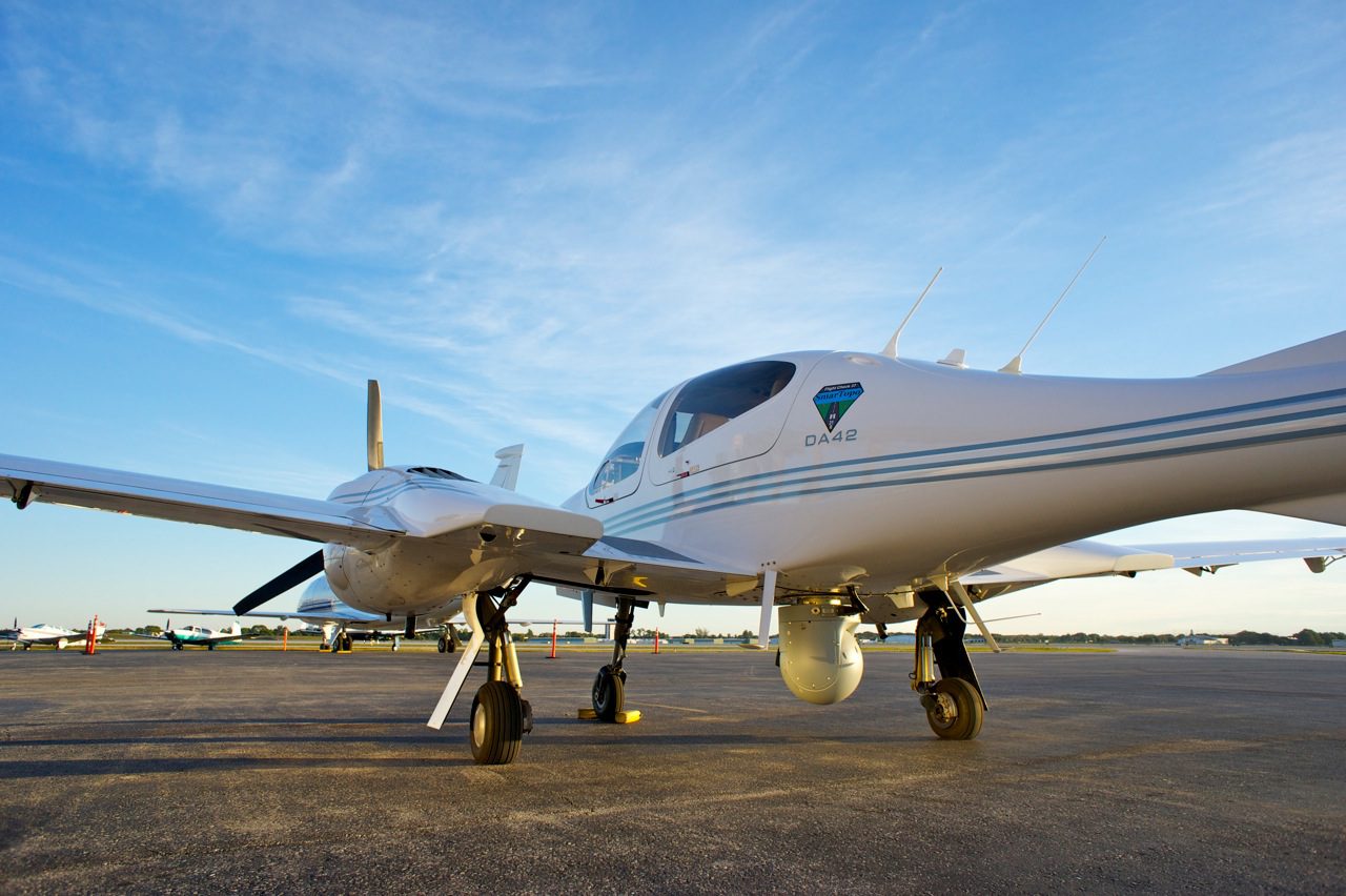
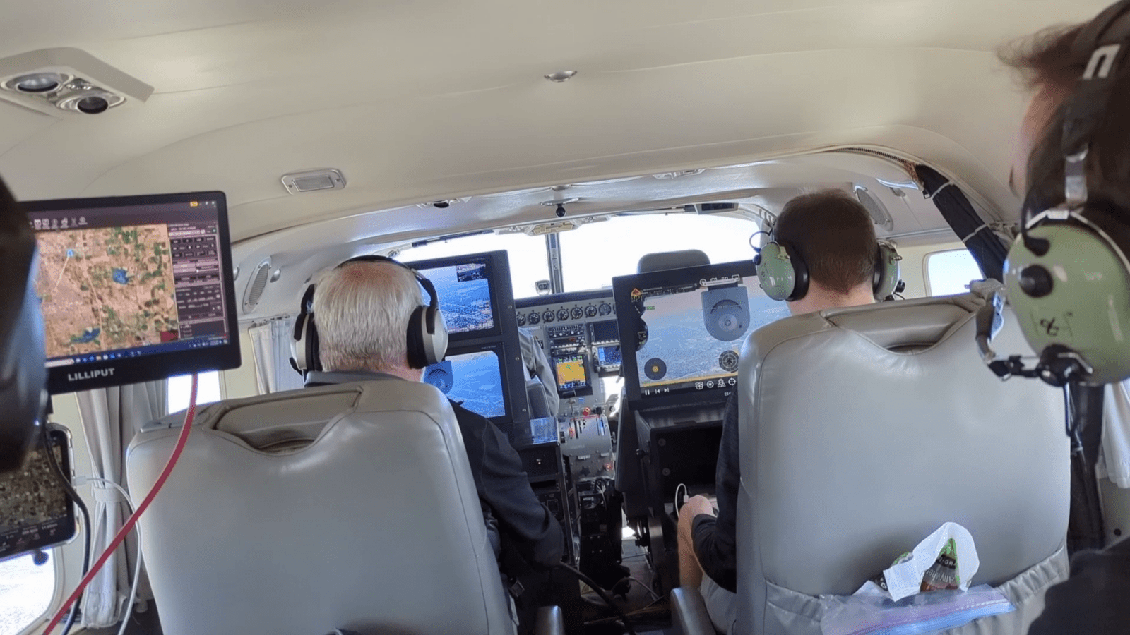
Carry-On
LandForm® X provides a carry-on capability, allowing sensor operators to carry their Mission Management System with them from aircraft to aircraft or back to the office for post-mission review.
User-Friendly
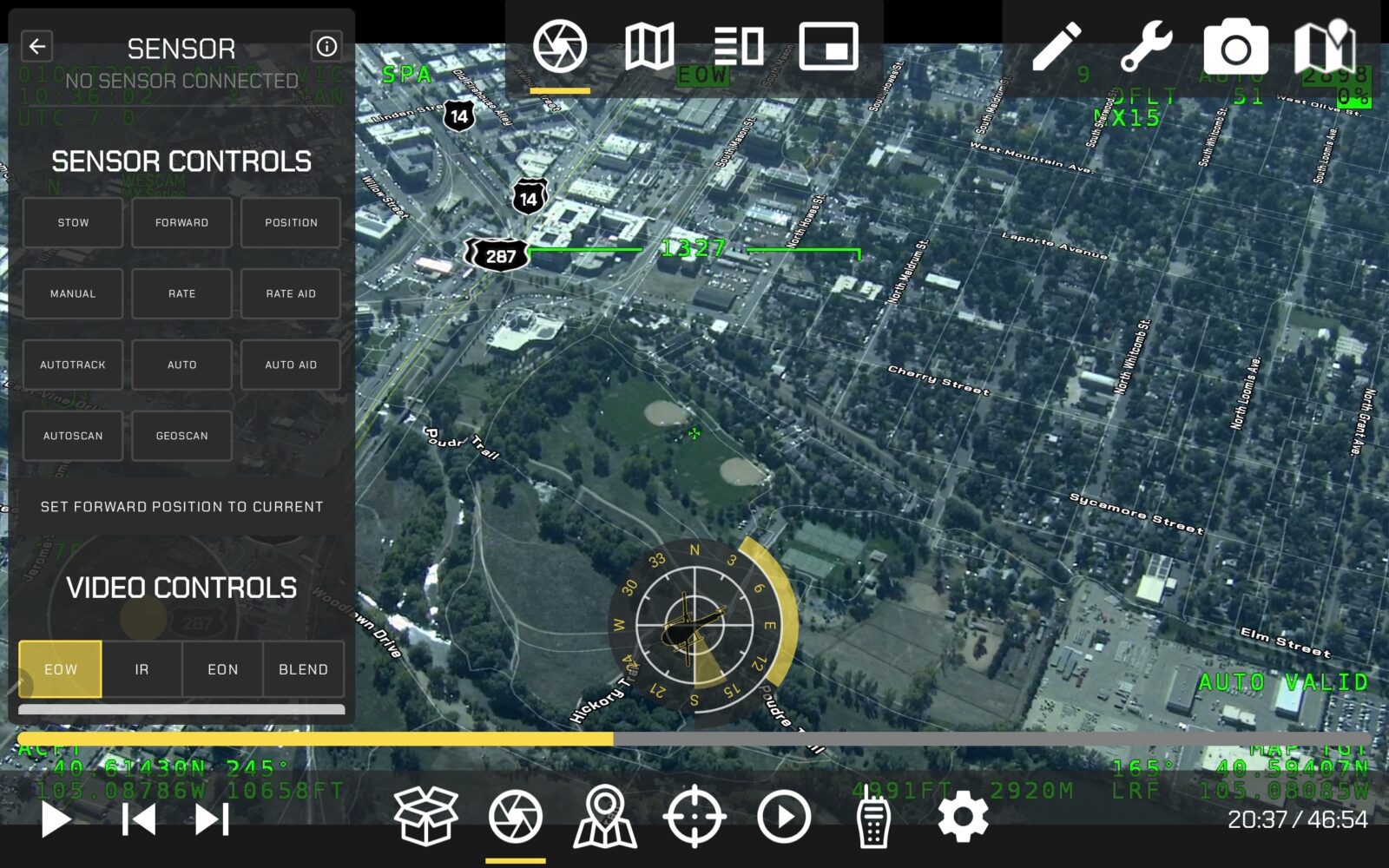
LandForm® X includes a user-friendly Android-based interface, which has the look and feel of a modern mobile application as opposed to legacy desktop software.
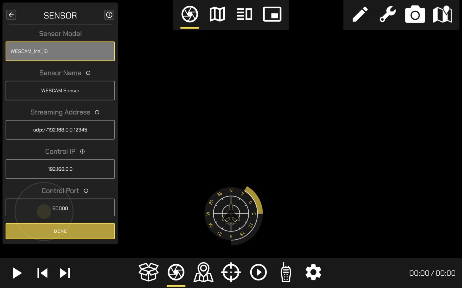
Sensor Agnostic
LandForm X is compatible with multiple major EO/IR gimbal platforms. Contact us for a complete list.
Full Sensor Control
LandForm® X provides full sensor control when connected via Ethernet or WIFI.
Geopointing
LandForm® X provides multiple geopointing methods when connected via Ethernet or WIFI.
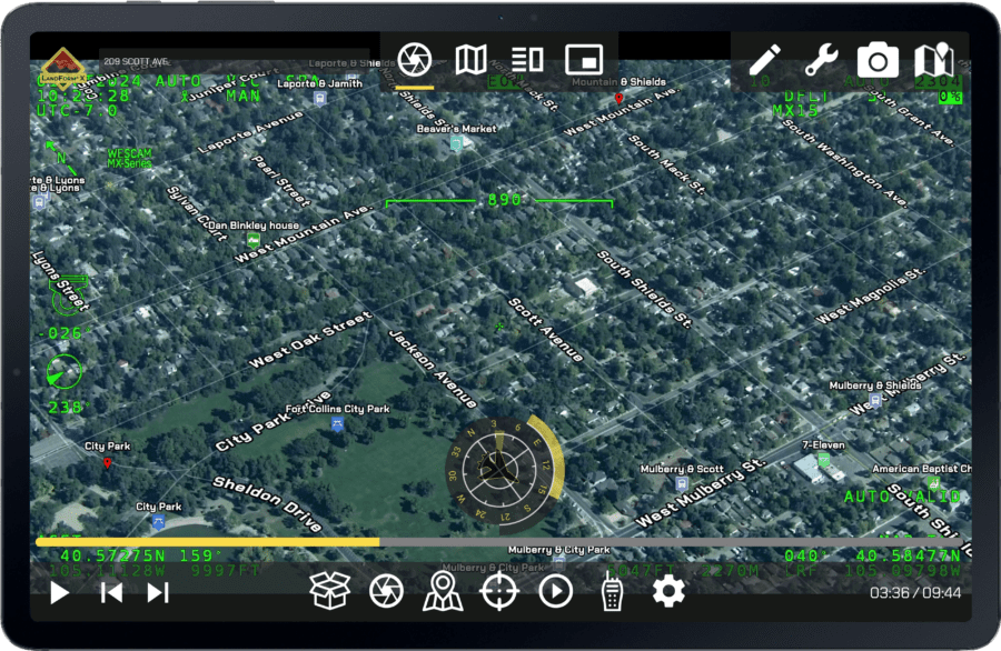
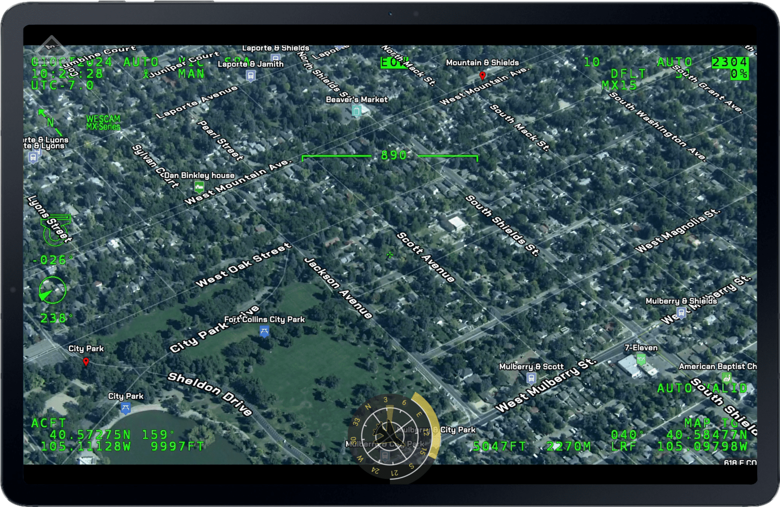
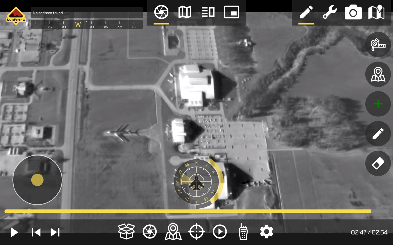
Moving Map Display
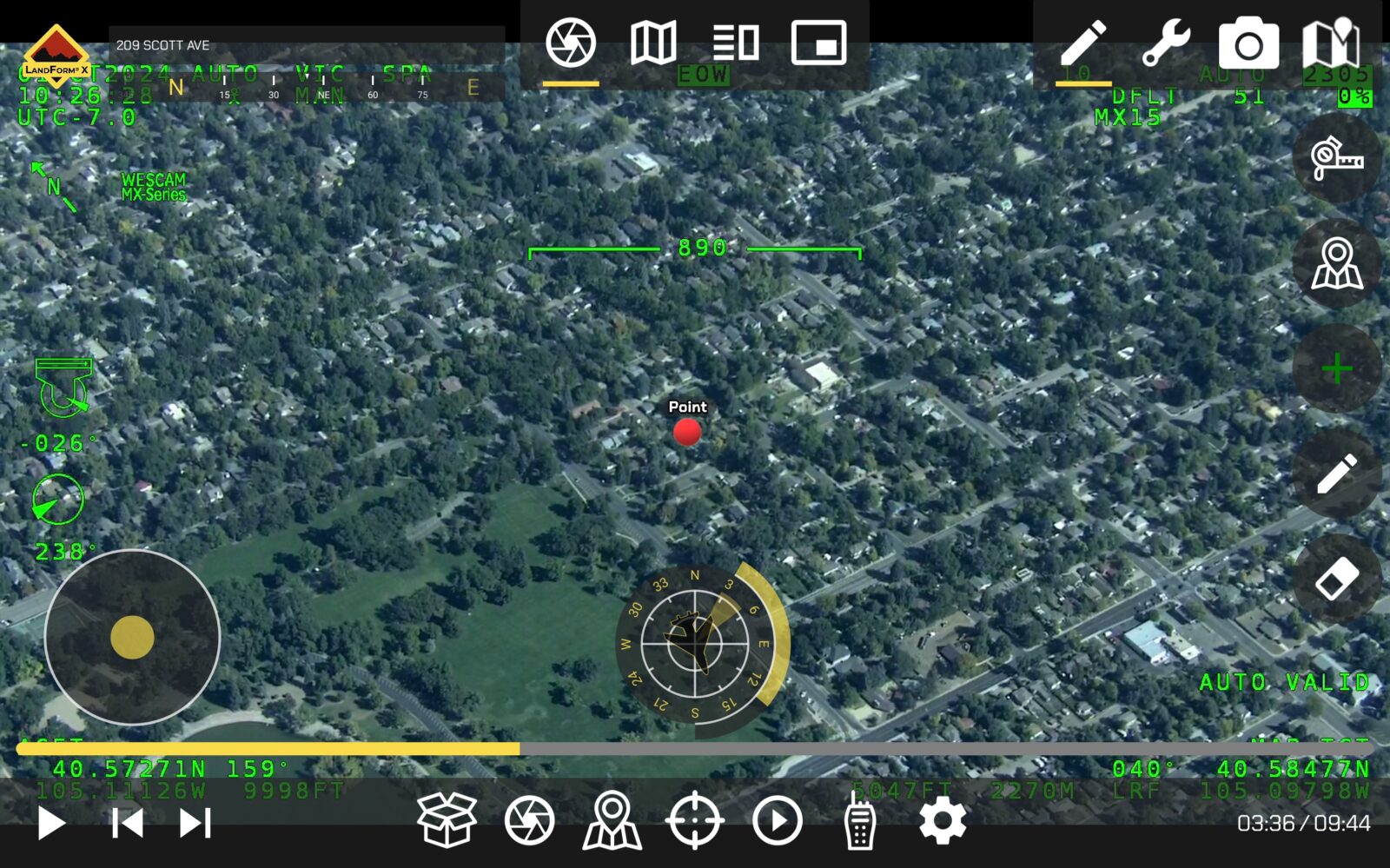
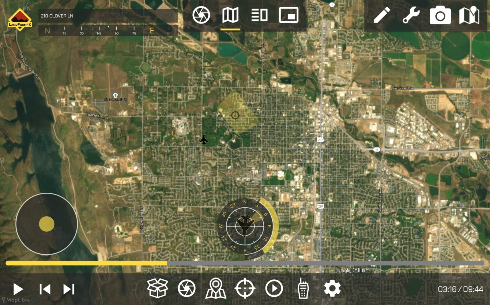
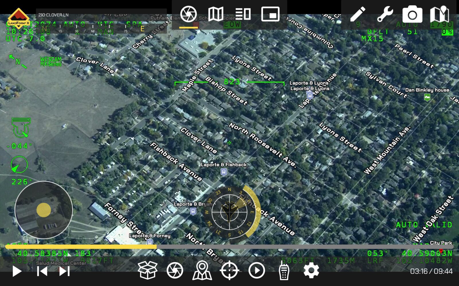
LandForm® X provides a moving map display with multiple viewing options (e.g., Full Screen Map, Full Screen Video, Split Screen, and Picture-in-Picture).
FMV Player
LandForm® X provides a full-motion-video player with multiple viewing options (e.g., Full Screen Map, Full Screen Video, Split Screen, and Picture-in-Picture).

Target List
LandForm® X provides a target list that can be populated pre-, in-, or post-mission. The target list logs all targets of interest and tags their timestamp and geolocation. It also provides a geopoint command and visibility controls.
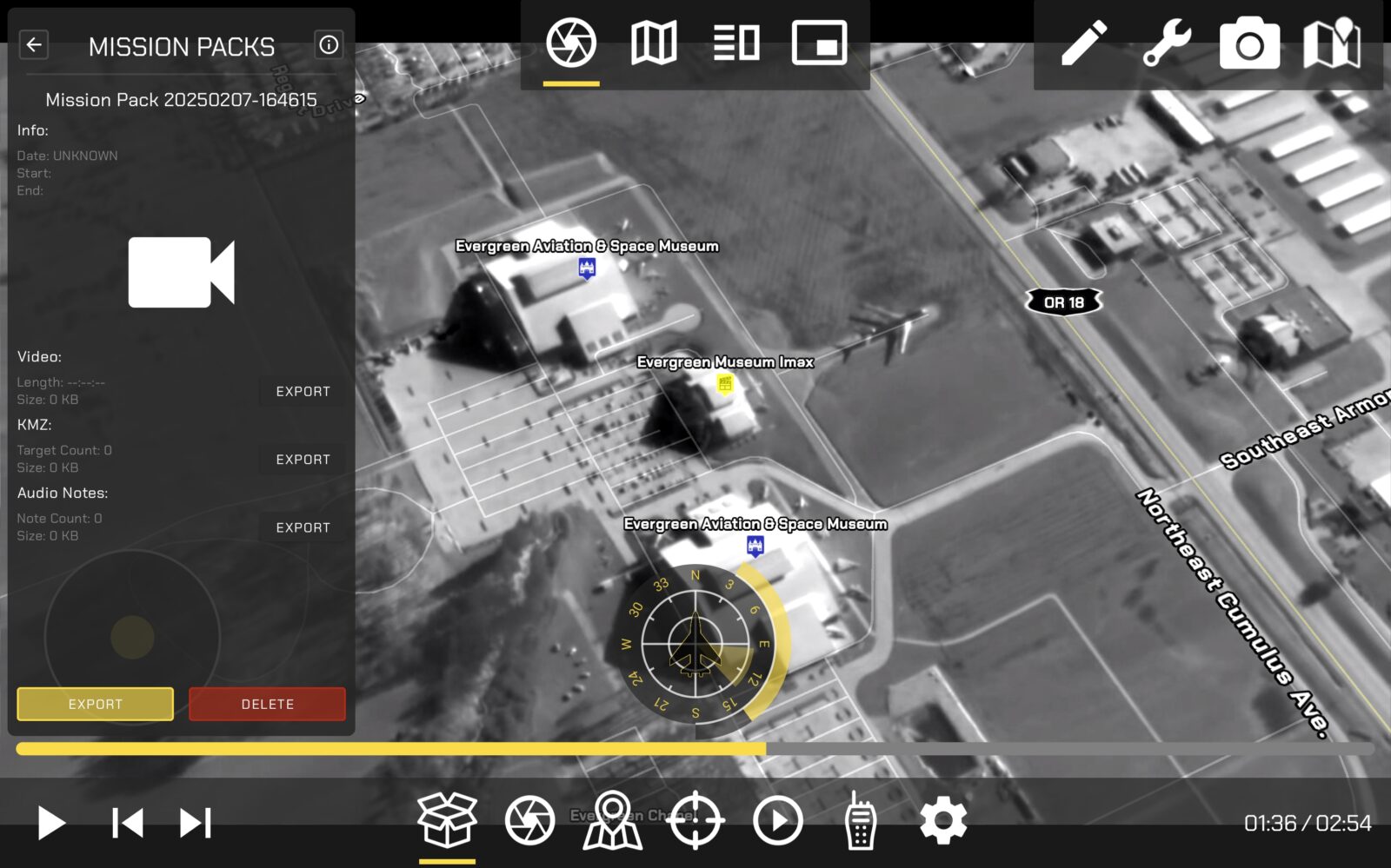
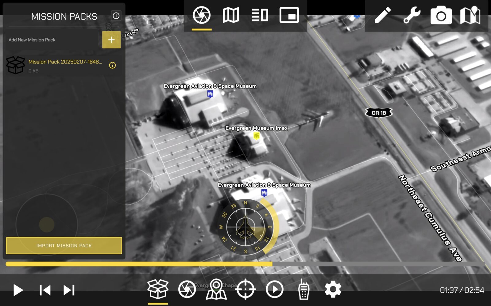
Mission Packs
LandForm® X allows TFOs and Sensor Operators the ability to save their Mission Data into a Mission Pack for post-mission viewing and analysis.
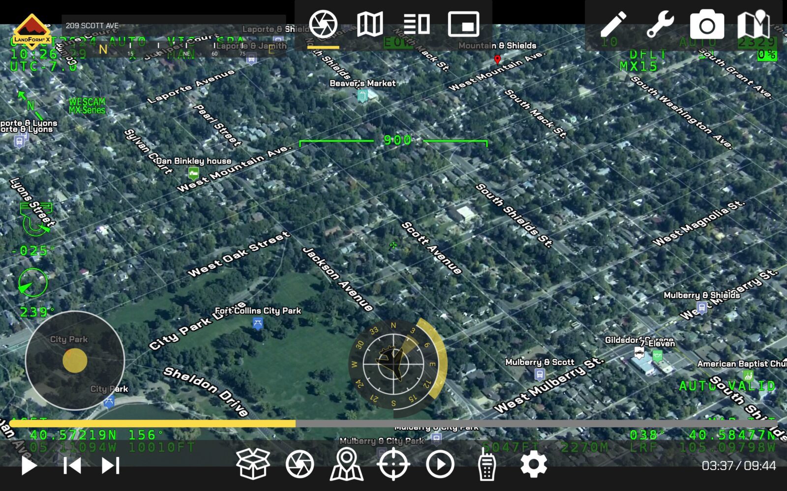
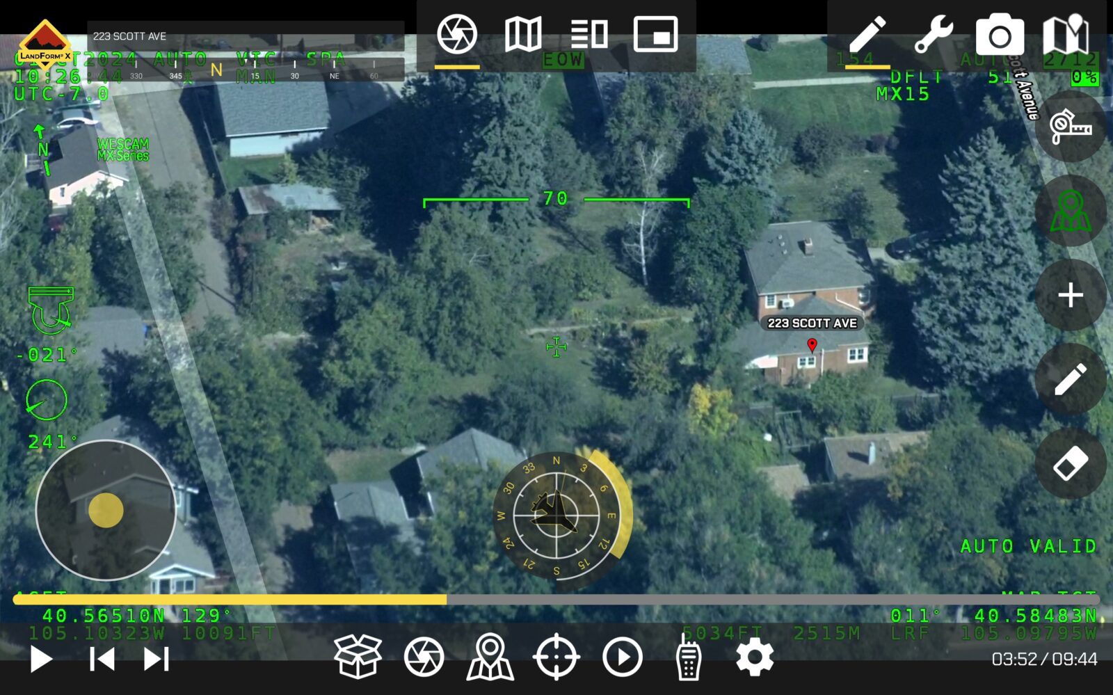
Geospatial AR
Embedded within LandForm® X is SmartCam3D®, a geospatial augmented reality library. The capability allows end-users to overlay nearly any entity with a geographic context onto real-time, full-motion-video (e.g., Road Vectors, Street Names, POIs, Custom GIS data, vectors, polygons, 3D objects, etc.).
Custom GIS Importing
LandForm® X allows users to import custom GIS data (e.g., .kmz) and display custom entities in the FMV.
FMV Geocoding
LandForm® X provides three geocoding options to forward- or reverse-geocode locations within live FMV.
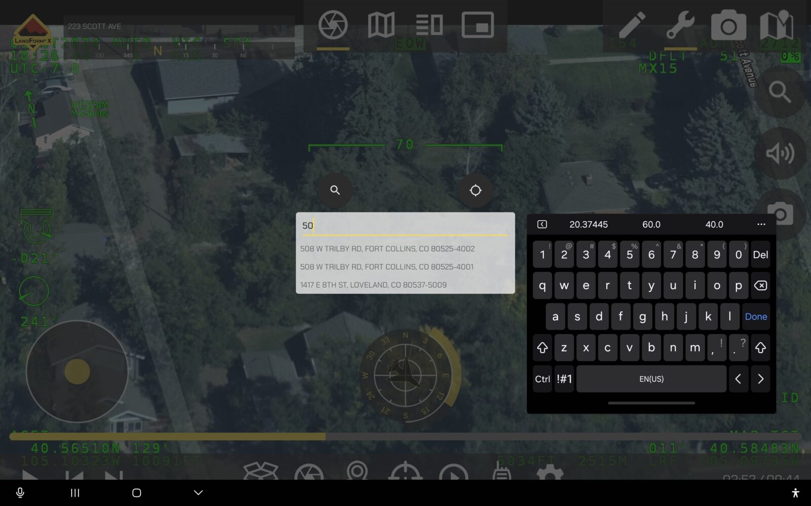
Address Autocomplete
LandForm® X includes an intelligent address search, which auto-completes search queries similar to Google Maps.
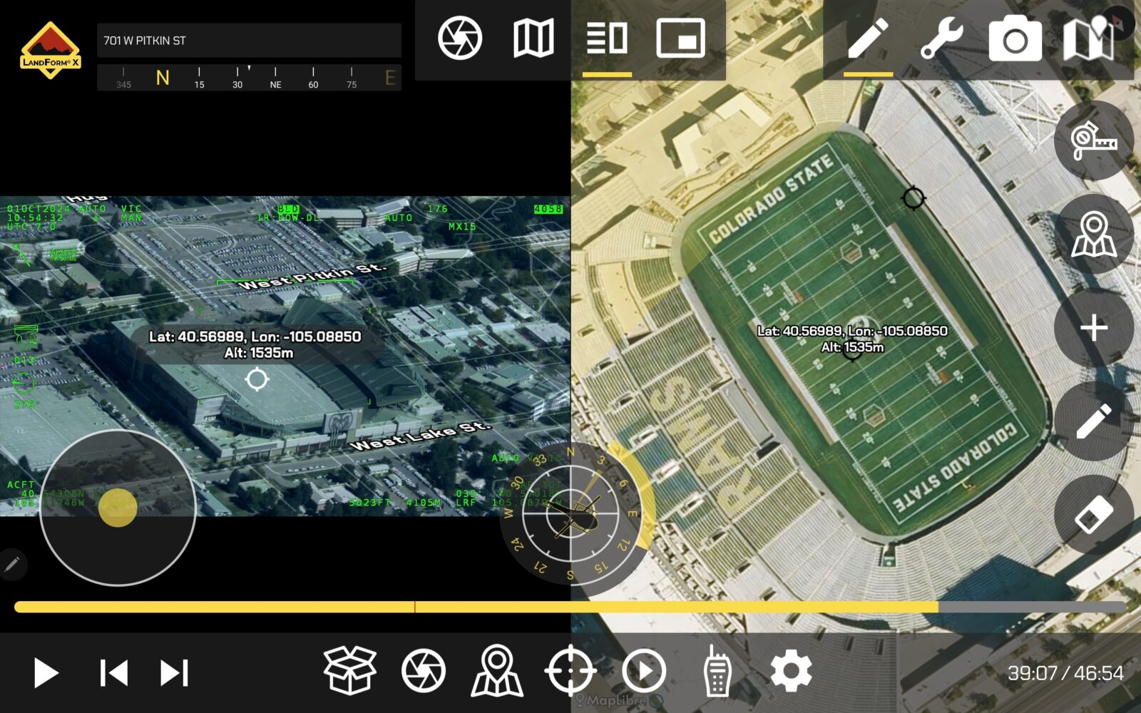
Cross Cueing
LandForm® X allows users to simultaneously navigate the map and FMV displays using an Active and Reactive cursors.
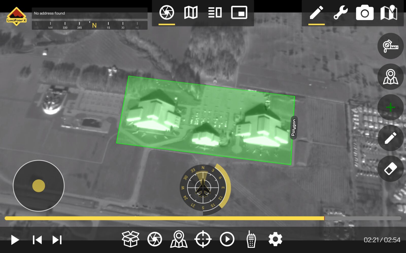
FMV Annotations
LandForm® X allows users to mark targets, draw line vectors, create polygons, insert text, and interact with the FMV as if it were a map display.
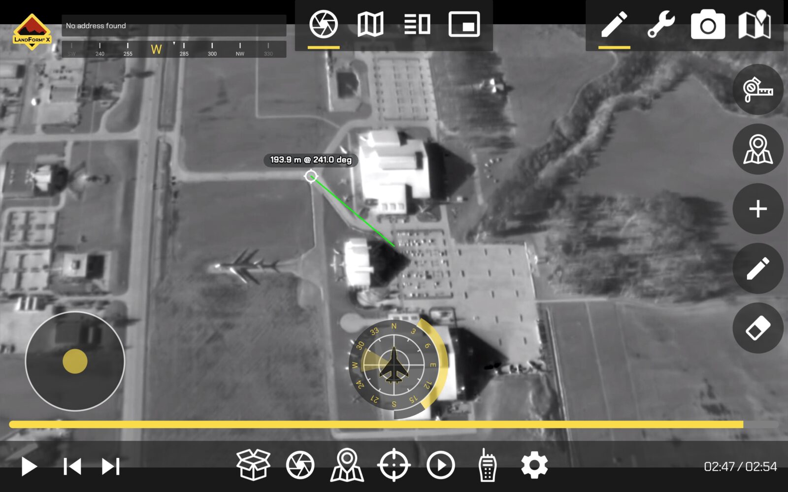
FMV Measurement
LandForm® X allows users to measure within live FMV. Range & Bearing tools are provided and users can also measure the areas of closed polygons.
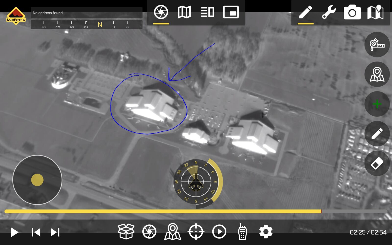
Geospatial Telestrator
LandForm® X allows users to free-hand annotate live FMV. Each annotation is logged in the target list and has a geospatial context, meaning it can be shared to separate map displays.
Elevation Query
LandForm® X allows users to query the elevation of any ground location within the viewing footprint. It also provides an automated read-out tied to the starepoint of the gimbal.
DVR
Built like YouTubeTV, the DVR within LandForm® X provides an intuitive user-interface allowing users to record, rewind, fast-forward, and skip-to pertinent parts of the mission. The DVR is integrated with the Target List, allowing users to skip to timestamps and geolocations associated with all FMV annotations.
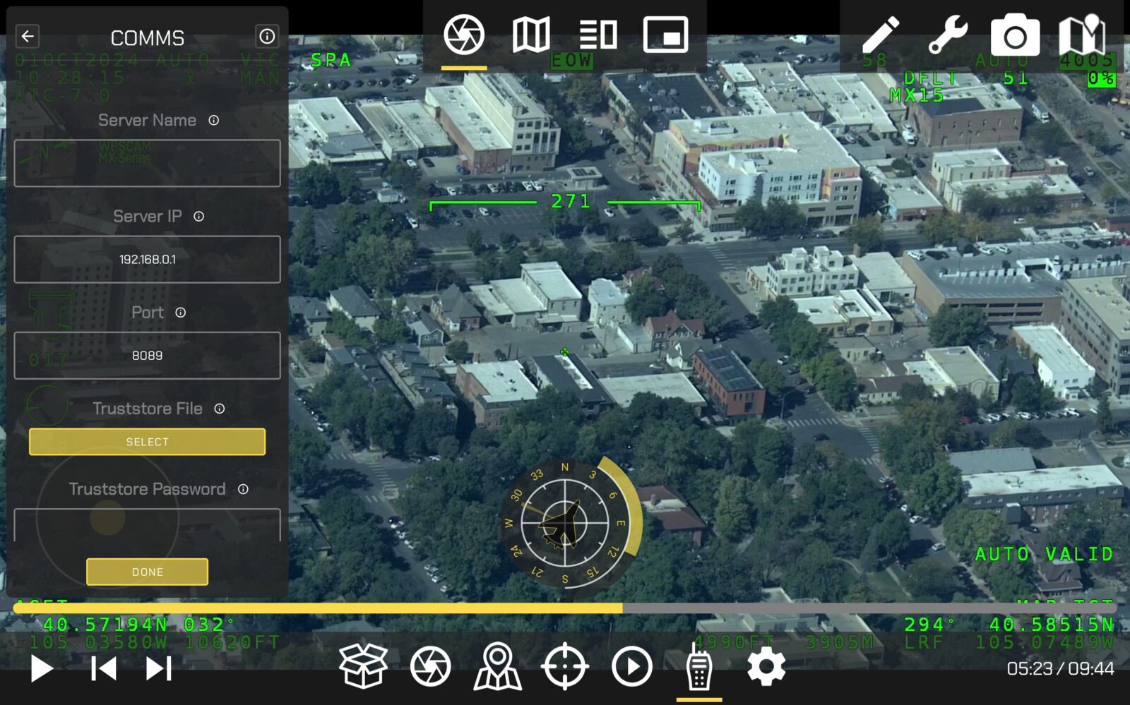
TAK Server Compatible
LandForm® X is compatible with TAK Server. This is becoming increasingly important for airborne law enforcement, Search & Rescue, and wildfire management, as agencies continue to adopt the TAK ecosystem.
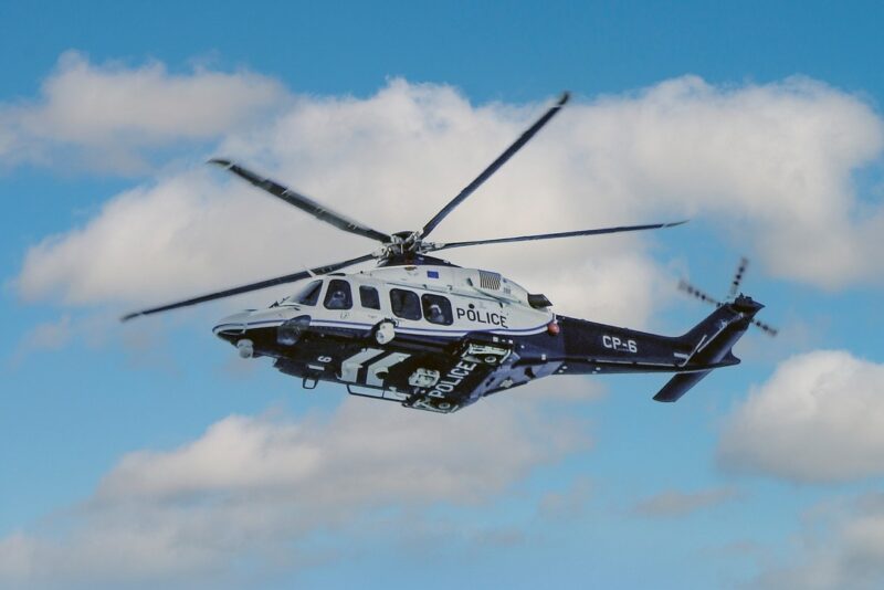
Airborne Law Enforcement
LandForm® X enhances tactical situational awareness with real-time geospatial tools and FMV annotation capabilities, ensuring efficient mission management for law enforcement operations.

Infrastructure Inspection
With geospatial augmented reality and precise FMV annotation, LandForm® X simplifies the identification and documentation of critical infrastructure anomalies during airborne inspections.

Maritime Surveillance
LandForm® X provides advanced geocoding tools to track vessels and monitor maritime activity, aiding in efficient regulatory enforcement and surveillance missions.
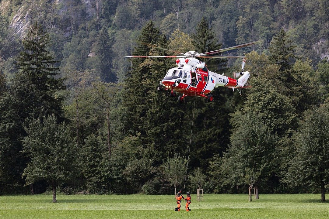
Search & Rescue
LandForm® X enables rapid geospatial data integration and live FMV annotation, helping search teams locate and mark critical areas in real-time during rescue operations.
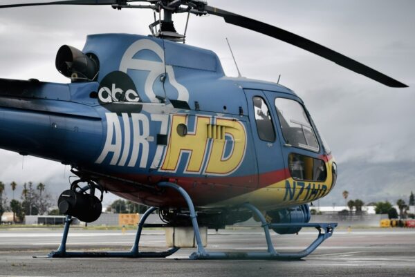
Video Production
LandForm® X offers seamless FMV annotation and map overlays, allowing producers to enhance storytelling with precise location data and visual insights.

Wildfire Management
LandForm® X combines geospatial data and FMV annotation to provide real-time insights, aiding in wildfire tracking, fire line drawing, and containment planning.
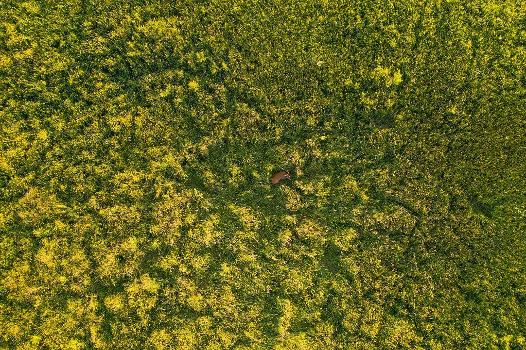
Wildlife Management
LandForm® X supports accurate geospatial visualization and FMV tools for tracking and analyzing wildlife populations.
Digital Overwatch
Real-Time Force Protection
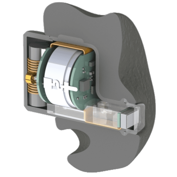
Ear Melds
Precision Audio & Health Monitoring Wearable
Foundation
Composable, Containerized Environment for Data Collection, Exploration, and Integration
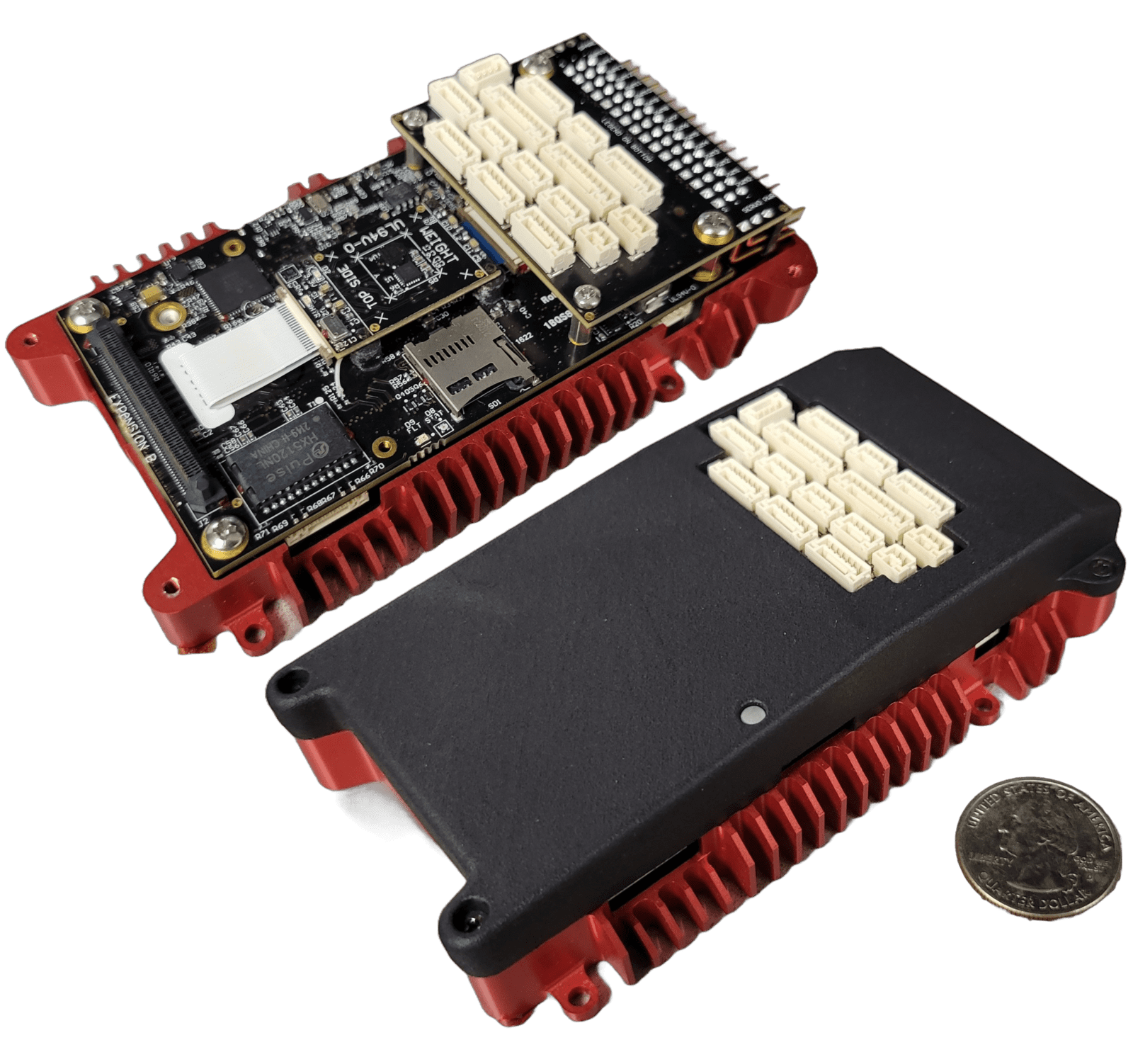
IronClad
NDAA-Compliant, Cybersecure, UxS Controller and Compute Module
LandForm® X
Carry-On ISR Mission Management System
Merlin
Spectrum Battlespace Mod & Sim Software for Multi-Domain Operations
SmartCam3D®
Geospatial Augmented Reality, Analytics, and Annotation Tools for Real-Time FMV

TAKaaS
TAK-as-a-Service
TAKX
Cross-Platform Situational Awareness COP and MMS
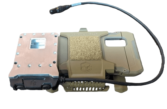
WAVE
LPI/LPD, High-Bandwidth Communications for Vehicles
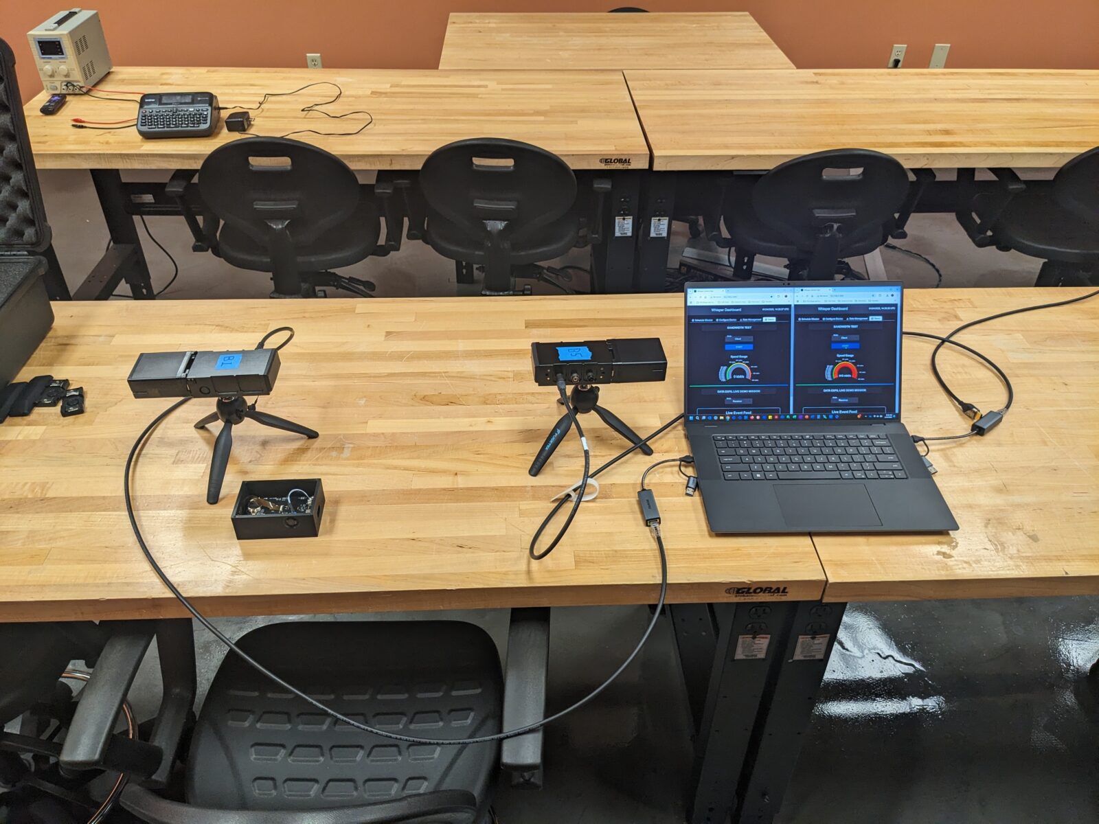
Whisper
LPI/LPD, High-Bandwidth Communications